RESEARCH ON HOUSE NUMBERING FOR URBAN MANAGEMENT IN PHÚ MỸ TOWN, BÀ RỊA-VŨNG TÀU PROVINCE
RESEARCH ON HOUSE NUMBERING FOR URBAN MANAGEMENT IN PHÚ MỸ TOWN, BÀ RỊA-VŨNG TÀU PROVINCE
Trần Duy Hùng
Mai Xuân Sảng
Nguyễn Trung Quyết
Faculty of Land Management and Real Estate, Agriculture and Forestry University, Hồ Chí Minh City
Đào Đức Hưởng
Southern Resources and Environment Company
Huỳnh Hữu Nghĩa
Văn Ngọc Cần
Phú Mỹ Town Urban Management Department
Abstract:
Phú Mỹ Town, located in Bà Rịa-Vũng Tàu Province, was established according to Resolution No. 492/NQ-UBTVQH 14 dated April 12, 2018, of the Standing Committee of the National Assembly on the establishment of Phú Mỹ Town and its wards. In recent years, the town has been invested in all aspects, particularly the technical infrastructure system according to the general urban planning direction (2002) and the adjustment of the general planning (2013) approved by the Prime Minister.
In parallel with the completion of urban planning, the town’s streets have been named according to regulations. Implementing house numbering based on unified, scientific principles suitable to local conditions, combined with management using GIS software on the cadastral map database, provides a basis for house number issuance and updates into the land database for land management and urban management in the coming period. The result is that house numbers have been assigned to 265 named streets in the town, distributed across 5 wards with a total of 18,209 houses on 31,257 land parcels.
Keywords: Phú Mỹ Town, house numbering, cadastral map, urban planning, GIS land management, urban management.
I. INTRODUCTION
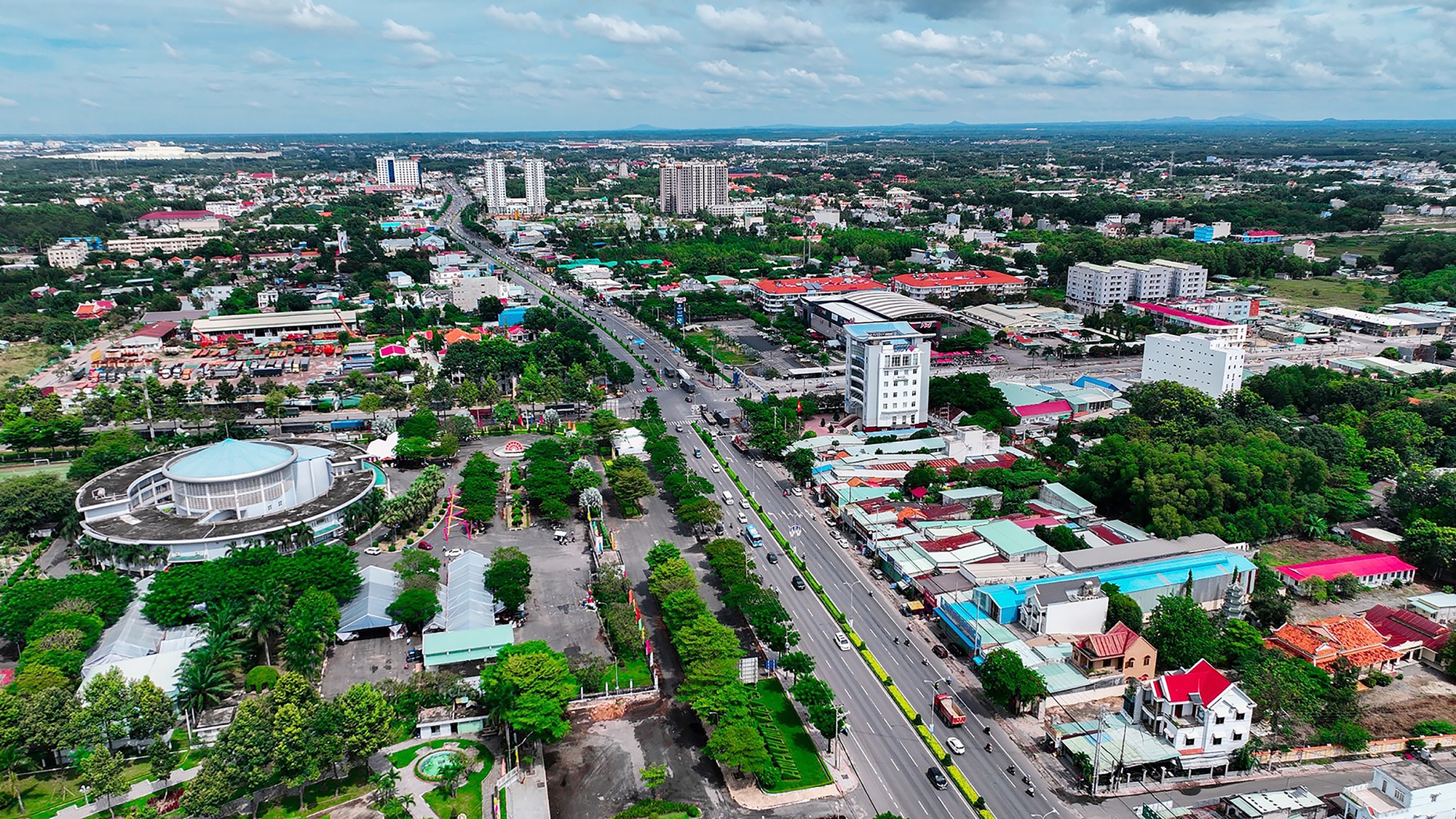
Phú Mỹ Town holds a strategically important position as a gateway to the East Sea, located less than 50km from Ho Chi Minh City via the HCMC-Long Thành-Dầu Giây Expressway and National Route 51, serving as a key transportation and trade hub for the province with the Southern Key Economic Region and international markets.
Phú Mỹ Town also plays a strategic role in the development of Bà Rịa – Vũng Tàu’s five key economic sectors: industry, seaports, port logistics services, tourism, and high-tech agriculture. Over the years, Phú Mỹ Town has developed an infrastructure network to transform this area into the province’s third most important urban center.
The main transportation network has been established, and most streets have been named, with many streets associated with notable figures, landmarks, and historical events. Housing management is carried out in accordance with Articles 139 (Housing Records Management), 163 (Housing Information System), and 164 (Housing Database) of the 2014 Law on Housing No. 65/2014/QH13, and noted in Article 189 of the 2023 Law on Housing No. 27/2023/QH15. House numbering is specifically regulated through Decision No. 05/2006/QĐ-BXD dated March 8, 2006, on the issuance of house numbering and signage regulations.
To ensure uniformity in urban management, administrative management, and to meet the urgent needs of residents and stakeholders in the town, the implementation of house numbering and issuing new house numbers based on unified, scientific principles combined with IT-based management is essential. This approach aims to promptly meet the socio-economic development and urban management needs of the locality in both the short and long term, contributing to the urban civilization, housing management, administration, and public order.
II. RESEARCH METHODOLOGY
- Research Area
Phú Mỹ Town, located in the western part of Bà Rịa – Vũng Tàu Province, covers an area of 333.84 square kilometers. As of 2020, it had a population of 197,109 people. The town comprises 10 administrative units at the commune and ward levels, including 5 wards and 5 communes.
Figure 1: Location map of the research area
Geographical Location:
To the East: adjacent to Châu Đức District; Southeast: adjacent to Bà Rịa City.
To the West: adjacent to Cần Giờ District, Ho Chi Minh City, and Gành Rái Bay.
To the South: adjacent to Vũng Tàu City.
To the North: adjacent to Long Thành District; Northwest: adjacent to Nhơn Trạch District, Đồng Nai Province.
Phú Mỹ Town is identified as one of the key economic centers of the province and the Southern Key Economic Region, serving as a port-industrial-logistics urban area, and an important gateway for economic exchange within the Southern Key Economic Region, Southeast Asia, and internationally.
- Data Sources
Secondary data collection method: Secondary data is collected from the Department of Natural Resources and Environment, the Land Registration Office of Phú Mỹ Town, the People’s Committee of Phú Mỹ Town, the People’s Committees of the wards, the Department of Natural Resources and Environment, the Urban Management Department, and the Statistics Branch of Phú Mỹ Town, including:
Data, Main Information | Agency |
Cadastral maps and cadastral records of 5 wards | Department of Natural Resources and Environment of Bà Rịa-Vũng Tàu Province |
Cadastral map adjustment records | Land Registration Office of Phú Mỹ Town |
– Maps of street names in Phú Mỹ Town. – Construction planning (General planning, subdivision planning, and detailed planning at 1/500 scale) | Urban Management Department of Phú Mỹ Town |
Old house number data | People’s Committees of the wards and the Urban Management Department of Phú Mỹ Town |
Current land use maps of the town and wards, land use planning maps up to 2030, Annual land use planning reports and maps | Department of Natural Resources and Environment of Phú Mỹ Town |
Annual statistical yearbooks | Statistics Sub-Department of Phú Mỹ Town |
Socio-economic reports | People’s Committee of Phú Mỹ Town and People’s Committees of the wards |
House numbering projects of some urban areas in Hanoi, Đà Nẵng, Hồ Chí Minh City | Websites of these cities |
- Field Survey Method
Investigate the current status of street names and houses along each named street, cross-check information, and verify field data related to houses and land to supplement, adjust, and complete the data and maps.
- Statistical Method
Compile the collected data on the current status of house numbering management and information gathered during the survey process.
- Data Processing and Analysis Method
After the survey, the data is updated in Excel spreadsheets, with information updated according to each land parcel, organized, and represented in the database as required.
Mapping Method: Use software to create maps, applying Microstation SE software to convert the current land use base map of 2019 and cadastral maps from “.dgn” format to “.tab” format, and Mapinfo software to process, analyze, and edit house numbering maps for the wards in Phú Mỹ Town.
GIS Tools: Use Mapinfo, MicroStation, and other software to integrate and build house numbering maps for the wards. This comprehensive approach completes the establishment of the House Numbering Map of Phú Mỹ Town.
- Principles of House Numbering
6.1. Numbering Houses on Main Roads (Frontage)
Identify the start and end points of the road (During the survey process, carefully review the approved records and the actual installation of street name signs).
House numbering direction is conducted from North to South, from East to West, from Northeast to Southwest, and from Southeast to Northwest.
If a house is located on multiple main roads and has multiple entrances facing different roads, the house number is assigned according to the road with the largest width.
If the main entrance (one main entrance) opens at the corner of the road, the house number is assigned according to the road with the largest width.
The house numbering direction is conducted from the beginning of the road (starting point) to the end of the road (endpoint). Odd numbers (1, 3, 5, …) are assigned to houses on the left side, and even numbers (2, 4, 6, …) to houses on the right side.
If a house is located on multiple main roads and has multiple entrances facing different roads, the house number is assigned according to the road with the largest width. If the main entrance opens at the corner of the road, the house number is assigned according to the road with the largest width.
Additionally, due to the unique characteristics of Phú Mỹ Town, which has National Route 51 running through the area, the rules for house numbering direction are as follows:
– For roads intersecting with National Route 51 from industrial zones, the house numbering direction is from the industrial zone outward (West to East).
– For roads starting from National Route 51, the house numbering direction begins from the first house on National Route 51 to the end of the road.
6.2. Inserting and Merging House Numbers
To ensure the stability and longevity of house numbering and issuance in the area, the following principles are applied:
– For roads that do not yet have complete houses (still vacant land), the reserve house number fund is implemented according to the principle “one land parcel corresponds to one house number.”
|
– In cases where the number of houses increases beyond the reserved fund (land parcel subdivision), house numbers are inserted by using the adjacent previous house number combined with a Vietnamese alphabet letter (A, B, C…).
|
– Houses built by merging multiple old houses will have house numbers consisting only of the first and last numbers of the old house number range, separated by a hyphen (-).
|
– Individual houses used (owned) by multiple households are assigned one house number according to the main road frontage house number or alley house number.
III. RESEARCH RESULTS AND DISCUSSION
- Compilation of Cadastral Maps by Ward Level
Based on the cadastral map sources for wards, represented through cadastral map sheets. The cadastral maps are overlaid and selected for elements that serve the investigation and house numbering process. After overlaying and selecting the necessary data, the result is a base house number map at the ward level.
Figure 4. Base Map Overlay with Satellite Image of a Ward (Phú Mỹ Ward)
Overlaying Google Earth images with the ward-level cadastral base map: To obtain an overall view and serve as a comprehensive reference, the latest satellite imagery data is collected to determine the overall boundaries of the entire ward as well as the boundaries of each land parcel within the ward. The overlay of Google Earth images provides a comprehensive visual reference. Using the Geographic tool on MicroStation V8i, the entire map is uploaded to Google Earth software to make decisions on effective map adjustments and standardization in the *.kmz file format.
- Overlaying Data from Approved Street Name Planning Maps (Streets with Street Name Signs Installed)
Overlaying street name planning data on the house number map helps identify areas within the ward that have been and are being planned to determine key economic zones, urban areas, and densely populated areas. This is crucial for field investigation, house number map editing, and house number verification. Conduct house number investigations for the streets with house number signs installed in the area.
Figure 5. Overlaying street name planning map on the base map
Based on this, investigate the streets with street name signs. Create maps of the streets that have names.
- Results of House Numbering Implementation in the Town
3.1. House Numbering and Information Entry on the Map
Figure 6. House numbering and information update for each land parcel
For the “sonhamoi” (new house number) field, house numbers are entered according to the established conventions. Other related information fields are selected and kept unchanged from the cadastral map.
The database (DB) information fields are standardized and serve as a basis for long-term development, including the following information fields:
– Old house number – New house number – Reserve house number – Street name – Road structure
| – Starting point – Endpoint – House status (With house/Without house) – Sheet number – Parcel number – Notes |
3.2. House Numbering Results
House numbers were assigned to 265 streets with street name signs in the town. The breakdown includes: Mỹ Xuân Ward with 53 streets, Phú Mỹ Ward with 134 streets, Phước Hòa Ward with 30 streets, Tân Phước Ward with 16 streets, and Hắc Dịch Ward with 32 streets.
Figure 7. Breakdown of streets with house numbering by ward in Phú Mỹ Town:
Mỹ Xuân Ward | 19.925% |
Phú Mỹ Ward | 50.376% |
Phước Hòa Ward | 11.278% |
Tân Phước Ward | 6.391% |
Hắc Dịch Ward | 12.030% |
The results achieved in house numbering serve the purpose of managing house number registration and issuing house number plates in the initial phase within the town. This also provides a basis for subsequent tasks.
Table 1. House Numbering Results in Phú Mỹ Town:
No. | Ward | Number of Streets | Total Houses | With Houses | Without Houses | Houses on the Left | Houses on the Right | Total Houses with Reserved Numbers |
1 | Mỹ Xuân Ward | 53 | 7,379 | 3,521 | 3,858 | 6,148 | 1,231 | 91 |
2 | Phú Mỹ Ward | 134 | 11,362 | 7,619 | 3,743 | 5,816 | 5,546 | 27 |
3 | Phước Hòa Ward | 30 | 4,080 | 2,548 | 1,532 | 2,101 | 1,979 | 146 |
4 | Tân Phước Ward | 17 | 2,593 | 1,603 | 990 | 1,344 | 1,249 | 67 |
5 | Hắc Dịch Ward | 32 | 5,843 | 2,918 | 2,925 | 2,901 | 2,942 | 106 |
| Tổng | 266 | 31,257 | 18,209 | 13,048 | 18,310 | 12,947 | 437 |
IV. CONCLUSION
Unified and long-term house numbering on named streets within the town contributes to effective urban management, administrative management, and especially the issuance of Land Use Rights Certificates and House Ownership Certificates. It facilitates economic, cultural, and social transactions for organizations and individuals, while also promoting historical and cultural education, fostering love for the homeland, and national pride. It serves as a basis for supplementing street naming and house numbering throughout the entire town (expanding areas without street names in wards, alleys, and rural areas), moving towards building a digital database for street and house management, and updating the land database within the town.
Implementing house numbering and issuing new house numbers based on unified, scientific principles combined with IT-based management is essential to promptly meet the socio-economic development and urban management needs of the locality both in the short and long term. The achieved results of house numbering aim to serve the management of house number registration and issuance in the initial phase within the town. This also provides a foundation for subsequent tasks in the next phase.
The house numbering map of Phú Mỹ Town is built on the cadastral map and the current land use map. Currently, the ward cadastral maps have been updated annually with land use changes. However, the town is a rapidly developing area with many regions experiencing significant changes in land parcel boundaries and landowners that have not been updated on the cadastral map, with some areas experiencing illegal changes.
Additionally, identifying the origins of house construction is challenging due to multiple management periods. Moreover, the area has many ongoing and planned projects, especially transportation projects. Therefore, the house numbering map should be oriented from the beginning to exclude land parcels that are not assigned house numbers in project areas or adjust when specific eminent domain boundaries are determined.
References
- National Assembly of the Socialist Republic of Vietnam, (2018). Resolution No. 492/NQ-UBTVQH 14 dated April 12, 2018, of the Standing Committee of the National Assembly on the establishment of Phú Mỹ Town and its wards.
- People’s Committee of Phú Mỹ Town, (2020). Proposal to recognize Phú Mỹ Town, Bà Rịa-Vũng Tàu Province, as a class-III urban area.
- People’s Committee of Phú Mỹ Town, (2020). Proposal for naming streets in Phú Mỹ Town.
- People’s Committee of Phú Mỹ Town, (2024). Proposal for the establishment of Phú Mỹ City and its wards.
- People’s Committee of Phú Mỹ Town, (2024). General planning for Phú Mỹ Town.
- People’s Committee of Phú Mỹ Town, (2024). Land use plan for Phú Mỹ Town in 2024.
- People’s Committee of Bà Rịa-Vũng Tàu Province, (2024). Planning for Bà Rịa-Vũng Tàu Province for the period 2021-2030 with a vision to 2050.
- People’s Committee of Ho Chi Minh City, (2012). Decision No. 22/2012/QĐ-UBND of the People’s Committee of Ho Chi Minh City dated May 31, 2012, on issuing regulations for house numbering and signage in Ho Chi Minh City.
- People’s Committee of Hanoi, (2014). Decision No. 04/2014/QĐ-UBND of the People’s Committee of Hanoi dated January 25, 2014, on issuing regulations for house numbering, signage, and public guidance signage in Hanoi.
- People’s Committee of Đà Nẵng, (2019). Decision No. 51/2019/QĐ-UBND of the People’s Committee of Đà Nẵng dated February 6, 2019, on issuing regulations for house numbering, signage, and issuing house number certificates in Đà Nẵng.
- National Assembly of the Socialist Republic of Vietnam, (2014). The 2014 Law on Construction No. 50/2014/QH13 dated June 18, 2014, of the National Assembly of the Socialist Republic of Vietnam.
- National Assembly of the Socialist Republic of Vietnam, (2009). The 2009 Law on Urban Planning No. 30/2009/QH12 dated June 17, 2009, of the National Assembly of the Socialist Republic of Vietnam.
- National Assembly of the Socialist Republic of Vietnam, (2014). The 2014 Law on Housing No. 65/2014/QH13 dated November 25, 2014, of the National Assembly of the Socialist Republic of Vietnam.
- Ministry of Construction, (2026). Decision No. 05/2006/QĐ-BXD of the Minister of Construction dated March 8, 2006, on issuing regulations for house numbering and signage.
- Ministry of Construction, (2006). Regulations for house numbering and signage (Issued according to Decision No. 05/2006/QĐ-BXD of the Minister of Construction dated March 8, 2006).
If you need more consulting, please Contact Us at NT International Law Firm (ntpartnerlawfirm.com)
You can also download the .docx version here.
“The article’s content refers to the regulations that were applicable at the time of its creation and is intended solely for reference purposes. To obtain accurate information, it is advisable to seek the guidance of a consulting lawyer.”

LEGAL CONSULTING SERVICES
090.252.4567NT INTERNATIONAL LAW FIRM
- Email: info@ntpartnerlawfirm.com – luatsu.toannguyen@gmail.com
- Phone: 090 252 4567
- Address: B23 Nam Long Residential Area, Phu Thuan Ward, District 7, Ho Chi Minh City, Vietnam